Colosseum Mine, Kingston Wash in Mojave Desert Cont.
KINGSTON WASH TRAIL
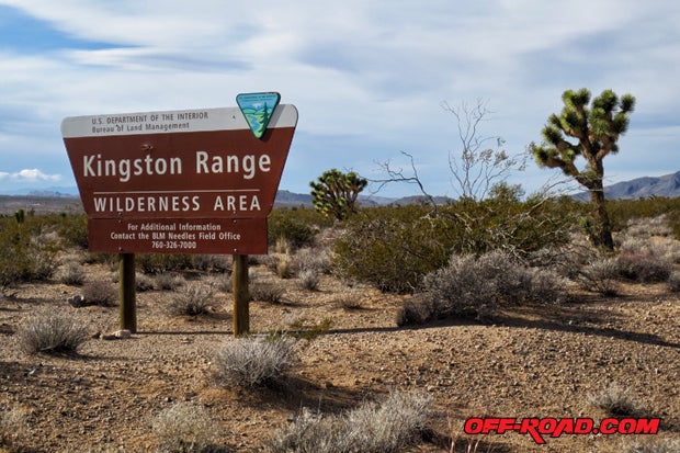
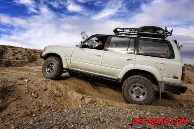
Our next stop was the Kingston Range Wilderness Area. The Kingston Wash Trail, found inside, offers a remote high desert experience for all off-roaders. The trail is OHV friendly, allowing legal travel through the southern edge of the Kingston Range for off-road dirt bikes, ATVs and UTVs. The trail starts at Excelsior Mine Road, inside the Kingston Range Wilderness Area, located about 27 miles southeast of Tecopa, CA.
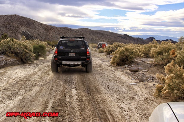
Heading southwest from the Colosseum Mine, we connected to the Kingston Range via the Mesquite Wilderness Area. Shane navigated our group down long stretches of dirt on Poleline Rd., then north on Excelsior Mine Rd. / Kingston Rd. until reaching the trailhead for the Kingston Wash Trail.
 made this stretch of the trip memorable and enjoyable to drive.")
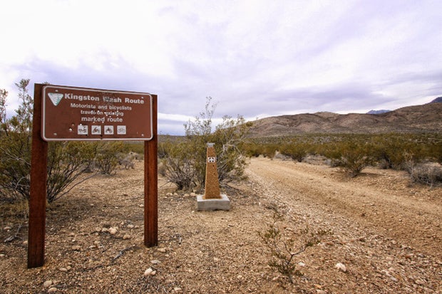
The Kingston Wash trailhead is well marked. We started on the east end, but it can also be traveled west to east starting at California Highway 127, near the old town site of Renoville. The trail meanders down a scenic desert wash, traveling through canyons filled with varied high desert vegetation and wildlife. It stretches a total of 30 dirt miles, with most of it being sandy with occasional boulders. Theres a series of old ashtray pedestals that mark the way.

The Kingston Wash once formed part of a travel route used by Native Americans crossing the Mojave. Good water sources could be found at Coyote Holes and Kingston Spring, making this path favorable. It was later used by the Spanish and then American settlers moving out west after the Mexican-American War. It was also a popular route for horse traders moving along the Old Spanish Trail.
In the 1920s, homesteaders came out to these parts to try their hand at cattle ranching and dry farming. Many left after the Great Depression ended and better opportunities awaited elsewhere.
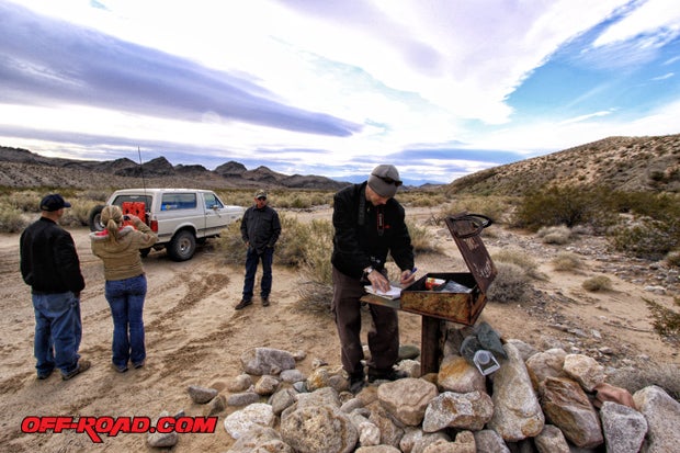
Five miles into the Kingston Wash we came across a rock pile and visitors book guarded by a thick metal box that reads Heritage Trail Box #2. It looks very similar to the box found on the Mojave Road Trail (See related article The Mojave Road: East to West).
The terrain along the Kingston Wash changes often, especially after a big storm. It may be necessary to scout for the trail if it has been washed away. Usually the tracks can be found close by on higher ground.
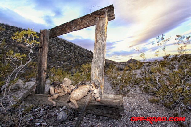
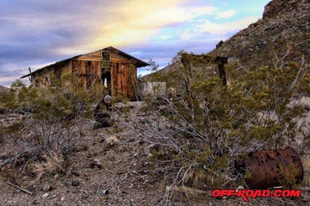
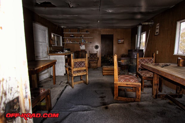
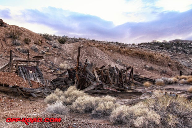
A short six-mile side trip from the Kingston Wash led us up to the Crusty Bunny Ranch. An old miners cabin and numerous relics are found here. We were met by a horse that looked very similar to one I had as a kid I always wondered what happened to that horse.
The old miners cabin is open to visitors, and supplies indicate that people still use it. Sources we found say it is open to the public and can be used on a first come, first served basis. It certainly needs some work, and would be a good candidate for the Adopt-A-Cabin Program. Be careful not to kick up dust, as mice droppings and urine on the surface carry the potentially fatal respiratory disease known as hantavirus.
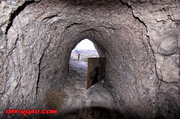
Within walking distance of the cabin is the Eastern Star Mine, known to have produced lead, silver, and zinc. Some old timber from dilapidated ore bins line the area between the Crusty Bunny Ranch cabin and entrance to the Eastern Star Mine. We took a quick peak inside the tunnel guarded by a swing door. Inside we found an old camping cot, water jugs and plenty of mice droppings. Tunnels go deep, but we stayed in the clear.

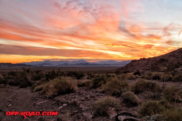
The Mojave Desert is an enchanting place. Great peace and inspiration can be found in the vast lonely lands of the great west. There is much to explore, and one trip always leads into another.
We hope you too will venture out to the Mojave Desert to explore. Go prepared, and preferably with friends. A good guidebook, map of the area youre exploring, along with GPS will make navigating this land much more enjoyable.
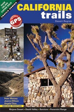
We highly recommend California Trails - Desert Region by Peter Massey / Jeanne Wilson, available at http://www.adlerpublishing.com/ and Amazon.
See you on the trail!
RESOURCES
BLM Barstow Field Office
2601 Barstow Road
Barstow, CA 92311
(760) 252-6000
http://www.blm.gov/ca/st/en/fo/barstow.html
Mojave National Preserve
2701 Barstow Road
Barstow, CA 92311
(760) 252-6100
http://www.nps.gov/moja/index.htm
|
Off-Road.com Newsletter Join our Weekly Newsletter to get the latest off-road news, reviews, events, and alerts! |
Follow @Off-Road
 Your Privacy Choices