Gold, Silver and Lead have all been found in the White Mountain range of California, located across from the Sierra Nevada Mountains. One of the most unique minerals found in the region is Andalusite.
The rare mineral was sought after in the early 1900s because of its properties and ability to resist high temperatures. It was used for hard ceramic porcelain, laboratory ceramic and spark plug insulators. A large deposit of the rare aluminum silicate mineral was discovered by Dr. Joseph A. Jeffery while on expedition to the Owens Valley region. Dr. Jeffery also happened to be president of Champion Sillimanite, Inc., makers of Champion Spark Plugs.
.")
What makes this off-road adventure unique is its remoteness and tie to automotive history. Visiting the Jeffery Mine (a.k.a. Champion Spark Plug Mine) requires a combination of 4x4 driving and hiking up an old pack mule trail.

Being that we are gear heads, we quickly gravitated to the automotive connection. The Champion Mine (a.k.a. Jeffery Mine) helped fuel the production of spark plugs that ignited engines made in Detroit and Ohio starting in 1920. After World War II, a man-made substitute for andalusite was discovered and ended the need to continue further mining in the area.
.")
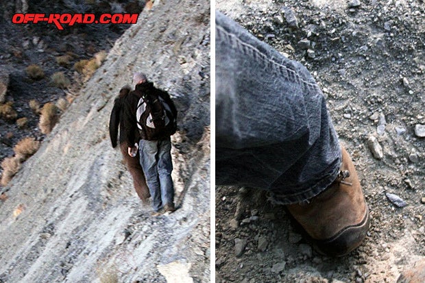
We decided to find the remote Champion Mine by tracing trails made by mule and men.
MOUNT UP
The Champion Mine trail is somewhat of a secret and not popularly documented. Its mostly known by locals and those willing to do some detective work. Part of it may be due to its remoteness; the other theory is that locals want to protect it from vandals. Either way, we were happy to find this historic place and notes on getting there.
We used the guidebook Inyo-Mono SUV Trails by Roger Mitchell, our Bishop Region Topo Map from Sierra Maps, and trail report from fellow off-roader D.A. Wright at http://www.gbr.4wdtrips.net/4x4/sparkplug4x4.htm.
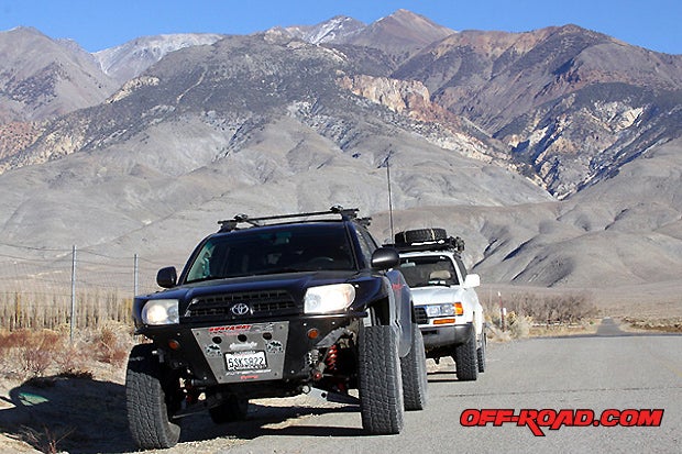
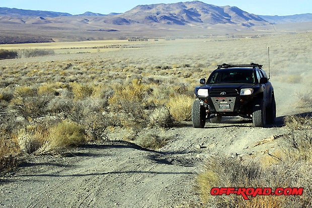
On this adventure, we had two rigs hit the trail. Kevin Blumer in his well-built Toyota 4Runner, me in the Land Cruiser. We started early in the morning from our base camp in Bishop, CA, heading north on HWY 6 for about 19 miles until reaching the old White Mountain Ranch, formally known as the Milner Ranch.
We turned right on White Mountain Ranch Road, and then drove less than one mile looking for our landmark, an old thermal generator building that was used to power the Champion Mine operation. From this point we were supposed to be able to start the dirt trail.
The large iron gate was locked and closed. It also had two signs that read No Hunting and POSTED No Trespassing.
At first we were really bummed because we had traveled over 300 miles (from home) to get to this point. We were looking forward to four-wheeling and hike up to Black Eagle Camp.

Kevin and I didnt give up, as we kept looking for an alternate route and studied our Topo Map and GPS. With some recon, we were able to find an alternate trail a few miles up the road. This new by-pass connects with the original trail from the hydroelectric power plant.
Big grins and back on track, we headed up Jeffery Canyon towards the Spark Plug Mine.
LOWER TRAIL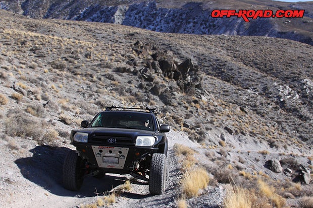
The trail runs about three miles to the lower hiking trail. It climbs quickly to an elevation of 5,000 ft. High above Jeffrey Canyon, we hit some patches of snow.
At about three miles, theres a tight switchback that heads to the upper hiking trail. Its easy to miss, especially with the eye-catching scenery around it. Not to worry, it can easily be picked up after turning around at the end of the main trail, less than a quarter mile away.
At the end of the lower trail we found remnants of ore bins that were used to hold the andalusite brought down by mule from the Champion Mine 4,000 ft. above. One can only imagine what this place may have been like--busy with pack mules and men transferring ore into wooden bins ready for a truck to haul down to the Carson & Colorado Railroad at the foot of the mountain, with the final destination Detroit, Michigan, where it could be processed for spark plugs.

The lower trailhead that leads up to Black Eagle Camp starts from the ore bin site. Its a difficult two-mile hike that quickly ascends 1,000 ft. Another option is to back track in your vehicle to the Y, less than .25 mile down the road. Steer right to the upper trailhead.
The hike is less strenuous from the upper trailhead; plus, you get more seat time behind your 4x4.
THE UPPER TRAIL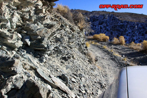
The upper trail puts you closer to the Black Eagle Camp, but it does require some harder terrain to traverse. The road is rough, with off camber areas and steep cliffs.
From this point, 4-Lo is recommended. The steep and narrow climb spans about 1.4 miles. Tall vehicles with high center of gravity are not recommended. A few eroded areas on the trail will lean the vehicle towards cliff side, offering plenty of pucker factor.

We drove up the trail at a slow and steady pace, keeping the wheels on the dirt and avoiding slipping off the edge. Full-sized track width is do-able.

We reached a parking area near the end of the upper truck trail. Look for sign and large open area. The road does continue on but eventually dead-ends. Turning around on this steep and narrow road should be avoided unless you have a death wish.
The hike from the upper trailhead is about 1.5 miles to the Black Eagle Camp. This way is shorter than the lower trailhead, but just like the truck trail, it is also much more narrow and has steep drop offs. If youre afraid of heights or carrying heavy gear, the lower trailhead may be a better choice.
BLACK EAGLE CAMP
The Black Eagle Camp housed and fed miners from the Champion Mine. Today the Champion Mine survives in a state of arrested decay thanks to the work of volunteers. For years, Don and Margy Fraser dedicated their life to repairing and preserving the mining camp. Today a number of buildings that once housed miners, cooks and supplies still stand above the Owens Valley. Some of the miners cabins are open for visitors to stay overnight.
")
We walked around the grounds, studying our surroundings, buildings and anything that looked remotely interesting. We did run into a couple that was staying in the Hilton cabin. They said they come up here every year, and prefer the late fall when less people visit the camp. The solitude fills their souls.
Even then, they were nice enough to show us around and point out some key areas like the work shed and water spring that hydrates the camp.


We didnt come fully prepared to make the second leg up to the mine workings on this trip. The day ran away from us, and we started to lose daylight. We had such a great time on this adventure that we are already making plans to return, spend the night in an old miners cabin, and then hike up to the mine workings at 9,000 ft. elevation.
For now, all we can say is that if you can make the trip, its worth doing. You get to experience history, rugged trails, and a place so remote and beautiful that only those willing to put in the sweat will be rewarded.

The best time to do this off-road trip is spring through early fall. Avoid the winter months as the White Mountains do get snow, especially at the higher elevations. Plan on at least two days to be able to properly explore the Black Eagle Camp and Champion Mine upper workings. At minimum, a full-day is required.
The Champion Mine and Black Eagle Camp are very special. Please take care of it, leave it better than you found it, and only take photos. If you have any supplies you would like to donate to the Adopt-A-Cabin program, do it. Water, firewood and canned food are always welcomed.
Some good resources to plan your adventure are found below.
Inyo-Mono SUV Trails by Roger Mitchell
Track & Trail Publications
http://www.trackandtrailpublications.com/
Sierra Maps - Bishop Region (Includes 4x4 and ATV Trails)
Available at most gas stations along HWY 395 and by mail order.
(760) 873-5838
White Mountain Ranger Station - Inyo National Forest
798 North Main Street
Bishop, CA 93514
(760) 873-2503
(760) 873-2501 TDD
http://www.fs.usda.gov/detail/inyo/home/?cid=fsbdev3_003862
Bishop Chamber of Commerce
690 North Main Street
Bishop, CA 93514
(760) 873-8405
http://www.bishopvisitor.com/
|
Off-Road.com Newsletter Join our Weekly Newsletter to get the latest off-road news, reviews, events, and alerts! |
Follow @Off-Road
 Your Privacy Choices