
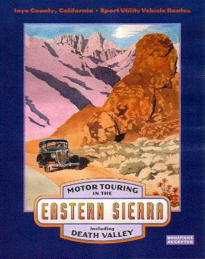
Bishop, California, is a quaint little town that sits cradled between the Sierra Nevada and White Mountains. Once the center of mining and cattle farming in the Northern Owens Valley, it has now established itself as a year-round outdoor playground. With fishing, mountaineering and a rich mining history, trails leading to some very unique and beautiful areas of the Eastern Sierras are waiting to be explored.

As is the case with all off-road traveling, a little planning and research goes a long way. We found some good trail guides for Bishop were sure youll enjoy. We recommend Sierra Nevada Byways by Tony Huegel. It offers scenic and historic off-road trails in Bishop and the Owens Valley. The guide has great descriptions of the area, trail ratings, turn-by-turn navigation and GPS waypoints. You can find a digital copy and more trail resources on the Trails.com website.
The Eastern Sierra Nevada 4WD Club (http://www.easternsierra4wdclub.com/) is also a great resource. The local club organizes runs throughout the year. They are also very familiar with the area and its history. Check out their website for upcoming runs and trail info.
The Bishop Visitor Center also offers FREE maps and Motoring Guides that highlight some of the trails and attractions in the area. You can visit their website for PDF downloads at http://bishopvisitor.com/map/motor.php3
VOLCANIC TABLELAND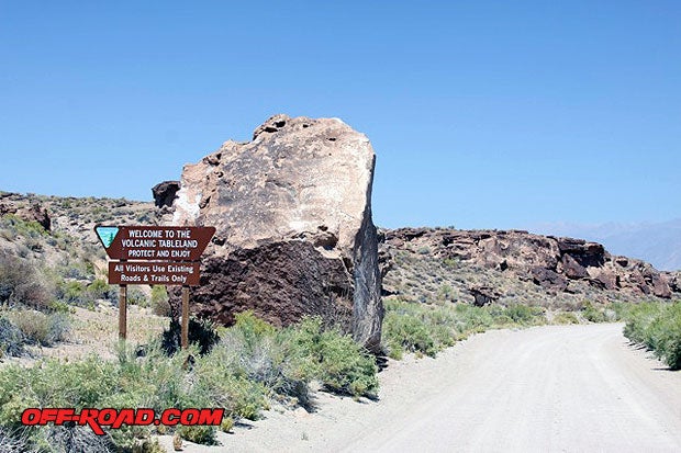
A great place to start your Bishop off-road adventure is at the Volcanic Tableland located north of town. The 52-mile point-to-point drive is easy to moderate with scenic views of the White Mountains and Eastern Sierra peaks.
The trail head is about 1.6 miles from Bishop on U.S. 6 (N37° 25.173' W118° 24.569'). Fish Slough Road (3V01) is the name of the main dirt road that drives through a 36,000-acre eco-preserve; old cattle ranches and an impressive collection of Petroglyphs believe to have been made by early Paiute and Shoshone Indians.


The desert terrain climbs to a tree line and vast series of rolling hills, near the Casa Diablo Mine. It then drops down on the back side of Crowley Lake--a man made reservoir on the upper Owens River that is used by the Department of Power and Water (DPW) to supply the Los Angeles Aqueduct.

The trip back into Bishop is an easy 20-mile drive down Hwy 395.
Most of the trail can be done in a full-size 4x4, but having a spotter is important to getting through tight sections near Casa Diablo Mountain.
THE COYOTES
Hidden behind the hills to the southwest of Bishop is an expansive area known as Coyote Flat and Coyote Ridge. This hidden gem is not apparent to the naked eye, yet is very attainable by most high-clearance, short-wheel-base 4x4, UTV, ATV or dirt bike.

The 55-mile round trip starts just west of Bishop, on Underwood Lane (N37° 20.795' W118°26.327'). There is plenty of room to park your trailer or truck if youre planning on using your UTV, ATV or dirt bike.
The trail starts by going through sandy washes and sagebrush-covered hills. There are some big rocks hidden in the sand, so cautious--we had a few sneak up on us. Thank goodness for skid plates.
After reaching some craggy peaks, a ravine with a series of switchbacks leads you from the desert floor to higher elevation. Soon you will reach the tree line.
The switchbacks are pretty tight, even in a Yamaha Rhino. Weve done it before in a short wheelbase 4WD truck, but its not recommended for a long wheelbase 4x4--like a Suburban.

If you like to visit old mine sites, there are two that can easily be reached in your 4x4.
.")
BUTTERMILK COUNTRY

West of Bishop is one of the West's most dramatic vistas that displays nature's contrasting desert floor: 13,000 ft snow-lined peaks and massive granite boulders of the Buttermilks. The area got its name from the old cattle farms that lined the region. The story goes that early miners would stop for a glass of buttermilk--and the rest is history.

To get to the trail head, take West Line Street (State Route 168) for 7.3 miles until you reach Buttermilk Road (7S01), just inside the National Forest.
The 14.7 mile semi-loop is an easy to moderate trail, with more difficult spurs. Be on the lookout for mountain bikers and boulder climbers as this area is known for both sports.
There are a number of trail spurs and open play areas.
WHERE TO STAY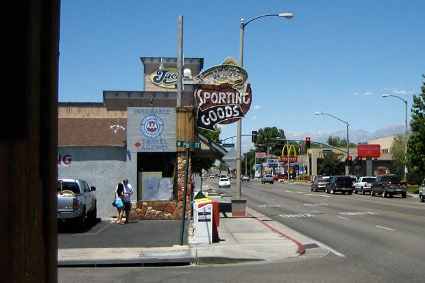
We frequent these parts often and think Bishop is the ideal place to set a base camp for exploring the northern Owens Valley region.
Bishop has plenty of hotels, RV parks and campgrounds near town. Bishop is a popular spot for fishermen, mountain climbers and train buffs.
 in Bishop, CA offers local history and a collection of trains from the old Carson and Colorado Railroad Co. Its a must see. (Photo Compliments of Laws Railroad Museum).")
Some of the local eateries offer good country cooking with plenty of High Sierra flavor. Make sure to stop at Jacks for a bite or the Looney Bean for a freshly roasted cup of coffee.
ATV rentals and guide services are available at Bishop Motorsports.
Keep in mind that this is snow country, so check the weather before you make plans. Most of the trails in the valley floor are accessible year round. The higher trails, like Coyote Flats, will not be accessible in the winter.
If you can plan it right, you can work in the Mule Days Parade and Festival in Bishop that takes place Memorial Day weekend. The annual event is the largest of its kind, and has earned Bishop the name of The Mule Capitol of the World.
SOURCES:
Bishop Visitor Center
http://www.bishopvisitor.com/
Trails.com
http://www.trails.com/
|
Off-Road.com Newsletter Join our Weekly Newsletter to get the latest off-road news, reviews, events, and alerts! |
Follow @Off-Road
 Your Privacy Choices