The Continental Divide — which consists of the Rockies and several other mountain ranges — splits the North American Continent into two watersheds. In other words, rain falling on the western-facing slopes eventually finds its way to the Pacific Ocean; while the eastern watershed drains into the Atlantic Ocean.
According to a Google search, “The Great Continental Divide Adventure Route is a motorized route that follows closely along the Continental Divide National Scenic Trail. This scenic trail runs from the USA/Mexico border into Canada and covers 2,767 miles of spectacular remote wilderness.” [Author’s note: About 2,700 miles of the trail is within the U.S. borders.] We were not following the official Continental Divide Trail — it’s for hikers only — since we were in Jeeps. We were following a trail suitable for motorized travel, and, because of the route’s length, we were towing camping trailers.
The Great Continental Divide Adventure Route is a scenic route that slices through several national parks, four or five states (depending on which route is chosen), crisscrosses the divide several times, and consists of pavement, gravel, dirt, and rocky roads. This spectacular trail is the direct result of a tremendous amount of effort by Kevin Glassett (aka GPSKevin; www.gpskevinadventurerides.com). Kevin has put years of personal effort into developing this route, along with several alternative routes along the way. As you can see on Kevin’s website, Kevin provides one main route (the blue line), some more difficult alternative routes along the way (the red lines), and several easier routes as well (the green lines). (GPSKevin also offers two-week adventure tours for dual-sport motorcycle riders, and is considering adding adventure tours for four wheelers.) In addition, memory chips are available through the website.
ALSO SEE: The Essential Off-Road Tools You Need for Safe Wheeling on the Trails
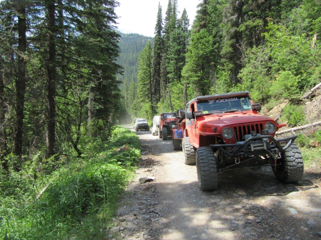
With the card in your GPS unit, you’ll see the route plainly delineated with a blue track (with arrows pointing southward). This blue track begins at the Mexican border where New Mexico SR 81 crosses it, and then flows northward through New Mexico, Colorado, Idaho, Wyoming, and Montana (a green line bypasses Idaho and takes you through Yellowstone National Park, which is the route we chose). At various spots along the blue route, Kevin has added alternative green and red tracks. Obviously, we had neither the time nor the funds to explore every alternative route along the divide, but we did sample several of them. While the blue tracks weren’t all that difficult, the green tracks were definitely easier—sometimes all pavement. Likewise, the red routes that we sampled weren’t extremely difficult, just more difficult than the blue road. Usually most of the red route was about the same as the blue, with a small section of it being difficult. Although, at least one red road was a single track suitable for a motorcycle only.
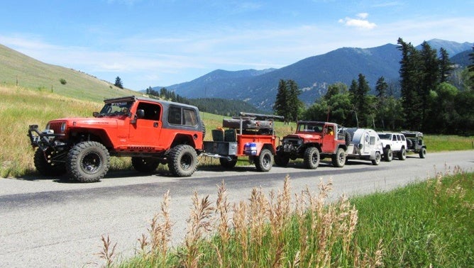
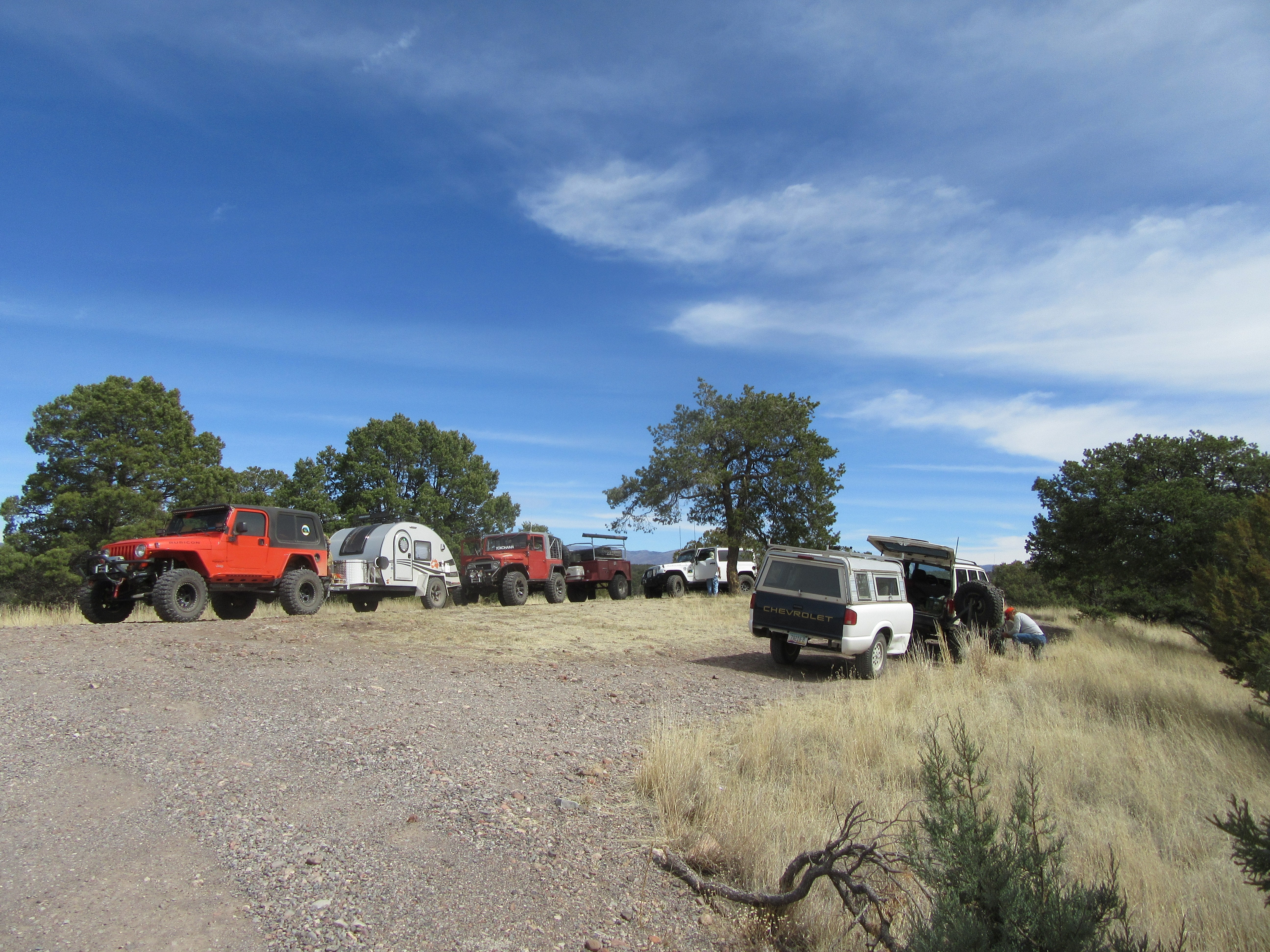
But even with a chip from Kevin, our expedition still took us almost a year of planning, which included assembling a cast of characters, their vehicles, and a sponsor. The vehicles ran the gamut from a 5-year-old Jeep to a 45-year-old Toyota FJ40, with two more Jeeps (a Cherokee and a Wrangler) in between—quite an eclectic selection of four wheelers—and four camping trailers.
You might say we were emulating the explorers of the 1800s but we were in Jeeps towing trailers rather than riding horses tugging pack animals or riding Conestoga or Studebaker wagons. Rather than cooking over campfires, we used Coleman stoves; rather than reading by candlelight, we used electric lanterns; and rather than sleeping wrapped in buffalo robes, we snuggled into sleeping bags.
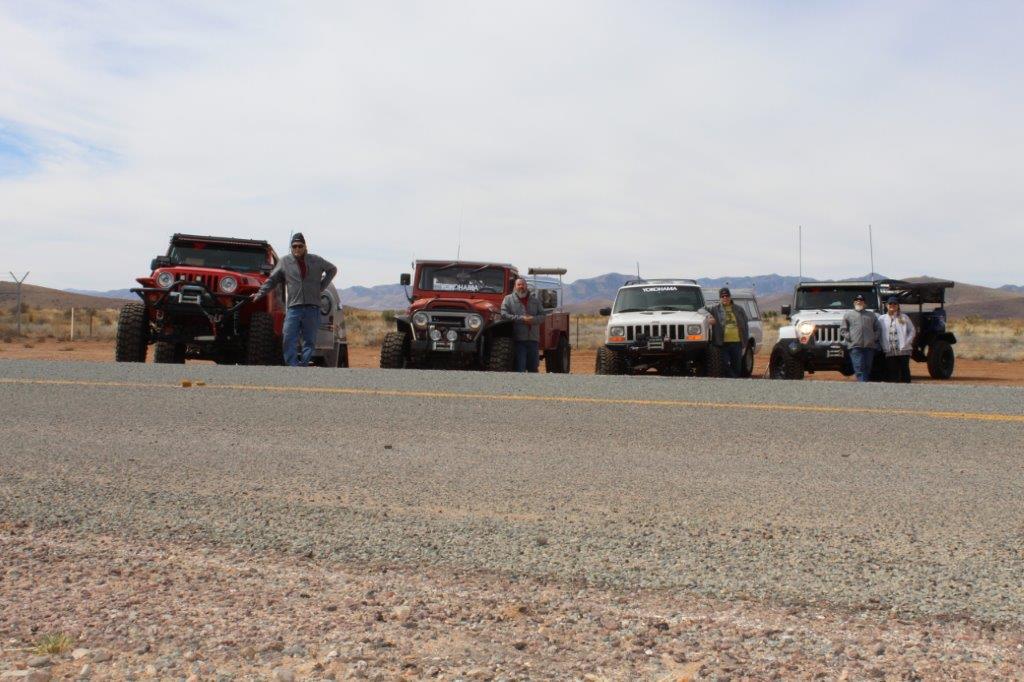
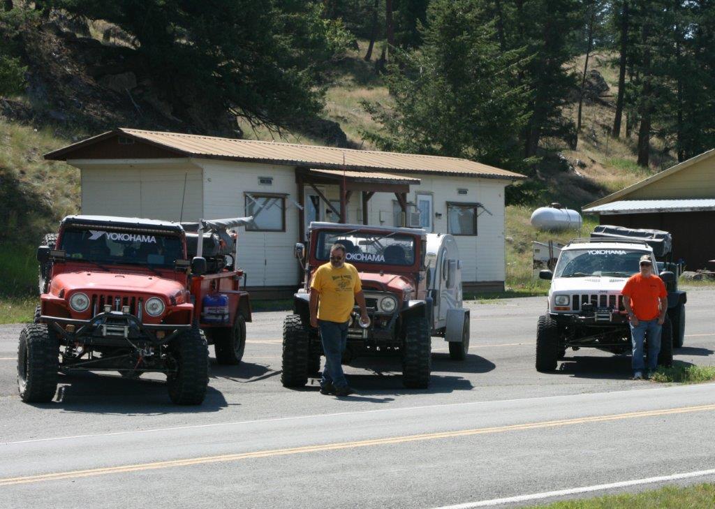
Over the past few years, Yokohama (www.yokohamatire.com) introduced two wonderful off-road tire designs—Geolandar MT G003 and Geolandar X-MT — with the X-MT design being the more aggressive of the two tire designs. Yokohama, thinking that 2,700 miles of all types of trails, roads, and highways would prove to be an excellent test, provided us with tires and fuel for all four vehicles; a set each of G003 for the 2013 Jeep Wrangler and 1999 Jeep Cherokee and a set each of the X-MT design for the 1974 Toyota and 2005 Jeep Wrangler. As it turned out, we accrued almost 8,000 miles total on the expedition because of all the highway travel to and from the trailheads.
ALSO SEE: Yokohama Geolandar X-MT Tire Review
Speaking of trailheads, because of various issues—health and mechanical—we completed the journey in three stages, much as you readers might do if you’re as intrigued as I with exploring the Continental Divide: First stage: Mexican border to Interstate 40, second stage: I40 to I80, and third stage: I80 to the Canadian border. By using the many interstates that cross the divide, an intrepid explorer can take the trail in shorter segments. Jump in and jump out at the various interstates as your free time dictates. For instance, turn north on the Continental Divide Trail near Albuquerque, New Mexico, drive the trail to I-70 near Vale, Colorado, and then head for home until you’re ready to revisit the trail. You can drive north on it or south, it’s completely up to you. Be fully prepared for any weather, though, because even in July, some of the higher passes through the Rockies could be clogged with snow, or inundated with vicious storms (hail, rain, and/or snow).
Our first night on the trail, since we began our epic journey at the Mexican border, was in the mountains of New Mexico, a few miles north of Interstate 10. At the time we were unaware that we’d be meeting hikers, mountain bikers, and dual-sport motorcyclists along the route, along with some fantastic folks living in the small mountain towns through which we’d be driving.
[Author’s note: If you don’t wish to shoot your own photos at the border, or have bragging rights about doing the entire route, or meet the nice folks at the Hachita Food Mart, a ride down State Routes 146 and 81 from Interstate 10 to the border is pretty much just a cruise on a two-lane highway over rolling hills through cattle country.]
One of the friendly small towns through which we drove was our third gas stop; Datil, New Mexico (on an alternate green route). At Datil we found a combination general store, motel, gas station, restaurant, and butcher shop, which also raised its own beef. It was called the Eagle Guest Ranch, and when we found that they raised and served their own beef, we decided to eat, shower, and sleep at the Eagle Guest Ranch. Just down SR60 from Pie Town (Pie Town’s claim to fame is two restaurants serving the best homemade pie west of the Mississippi), Datil is a must stop for anyone who enjoys a good beef steak with all the trimmings, served by some of the nicest people you’ll ever have the joy to meet.
Perhaps now is a good time to discuss possible vehicles for this adventure. As I mentioned earlier, along this trail you’ll meet hikers, motorcycle riders, and mountain bikers (amazingly, the mountain bike record for the 2,700-mile border-to-border route is a mere two weeks!). Therefore, you can pretty much do it in or on just about anything with plenty of clearance, good off-road tires, and low gears, but I highly recommend a Jeep with strong off-road tires such as the Yokohama Geolandars. Why? Because if you’re lucky, you may drive the entire length in sunny warm weather, but that’s very unlikely. More than likely, you’ll hit rain or snow, which means mud and washouts. Which also means you’ll need the clearance and traction that off-road tires and low range will give you. And if you’ll be towing trailers, as we did, the tag-alongs will also require clearance and tough tires.

Another recommendation: For most of us, driving through the high lonesome on the continental divide will be a one-time thing, in other words a trip of a lifetime. That’s why we treated the divide route like the trunk of a tree, with branches out both sides, but always returning to the basic route root. Famous locations like Santa Fe, Jackson Hole, Leadville, Pikes Peak, Yellowstone National Park, and many other national parks adjacent to the route can be visited while you make your way along America’s spine—you (or your group) should make up your own list.
When you’re assembling a group for an adventure like this one, you must make sure everyone is compatible. With our group it was easy; we’d all four wheeled together for years and had traveled with each other on a camping trip or two. We thoroughly enjoyed each other’s company—plus our dogs got along. Consider all these things while assembling a group and planning your trip.
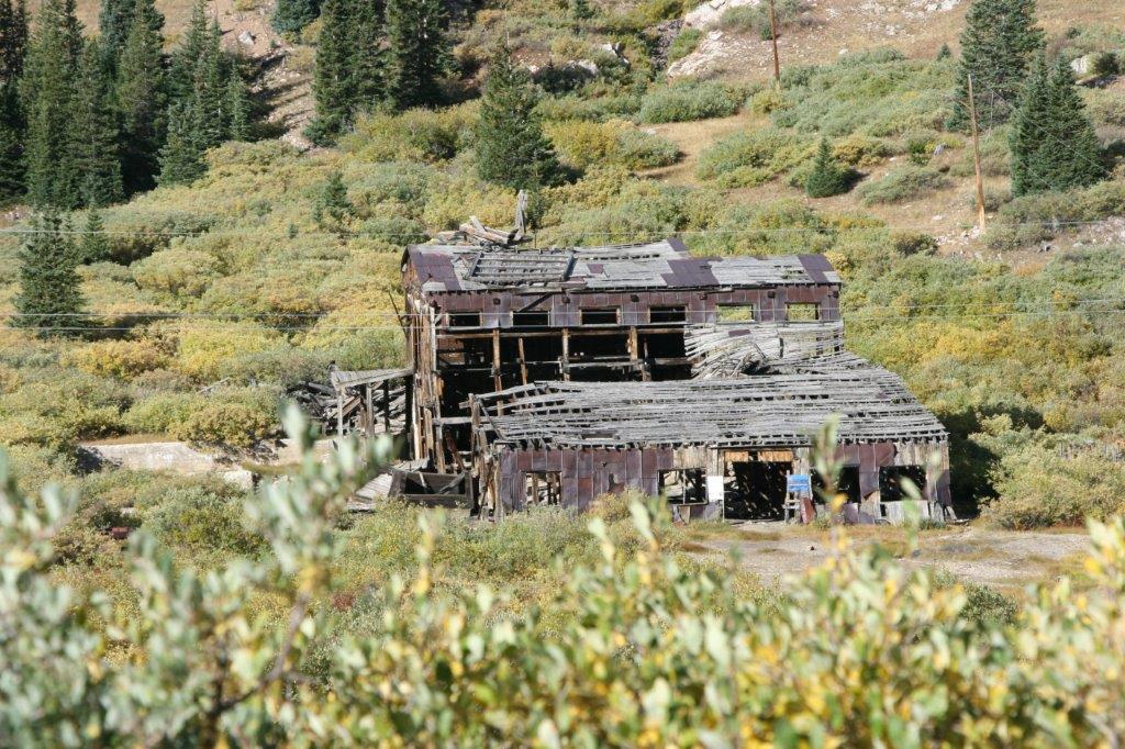
One of our side trips was Leadville, Colorado. Once known as Magic City and Cloud City, and situated nearly two miles in the sky, Leadville enjoyed two gold rushes with a major silver strike in-between. People used to describe Leadville’s climate as ten months of winter with two months of late, late fall. Well, the day we drove through it was like early fall with a sunny day in the mid-70s.
We took Mosquito Pass into Leadville and the 13,185-foot pass between Leadville and Fairplay required all the clearance our vehicles had and their transfer cases’ low ranges, but the history, the relics, the mine shafts, and scenery were well worth the effort. Being the descendant of two Western icons—a cavalry scout on the plains and a member of Butch Cassidy’s Wild Bunch—I came by my fiddle-foot tendencies honestly and all the attractions of Mosquito Pass and Leadville called to me and my calling infected the others in my group.
Much of the surface over which we traveled on the Great Continental Divide Adventure Route was macadam, but there was also plenty of dirt, rocks, and gravel, so we needed tough tires with strong sidewalls and high traction treads, which was well provided by the Yokohama Geolandar tires—both designs—without a single flat tire for the entire trip.
ALSO SEE: 10 Best Off-Road Tires and How to Pick the Right Ones
I mentioned a couple of our favorite eateries early on but I would be sorely remiss if I didn’t also mention the Café Jax in Eureka, Montana (very near the Canadian border). Café Jax sounds like it serves those tiny meals known as nuevo cuisine; however, think lumberjack-size servings instead. Before jumping off on the Continental Divide Trail—or celebrating its finish (depending on which direction you’re traveling)—have a great meal at Café Jax—we thoroughly enjoyed the huge serving of kielbasa hash and eggs. If the weather warrants, enjoy its patio. It has great coffee, huge portions, delicious vittles, and a wide selection on its menu.
Café Jax was our final breakfast while actually “on the trail.” We’d just camped for the final night on the trail and parked at the border for our completion photos, and were celebrating our “victory.” All we had left to do was to wend our way home on the wonderful and interesting US Highway 93.