Photos by Jaime Hernandez and Justin Fort
 |
When was the last time you hit dirt in your own backyard? You can find and run neighborhood and regional trails in many parts of these United States. Off-Road.com is going to take pains to spell out details of localized trails – what we’d like to call “backyard off-roading” – helping you explore the nooks & crannies in your own woods (or in someone else’s). We’ll also highlight underappreciated trails, and introduce your fellow off-roaders to previously unknown runs.
We’re going to give you a collection of how-tos (get-tos, really) on exactly where to venture fourth and get dirty in your backyard. Off-Road.com can build up your confidence enough that you’ll point your hood ornament away from home more often. Now go buy a hood ornament.
 |
| Lovely stands of old growth can still be found in the mountains above Ramona. Not everything burned during the local area fires, and what did is growing back. |
Ramona, CA – San Diego’s Country Cousin
Just 40 minutes out of San Diego (and 1400 feet above), pinched between four small mountains (including Black Mountain), lies a town of about 17,000 fine folk: Ramona, California. Perhaps thanks to the historically rustic nature of the locals, a suite of trails providing quality access to Ramona’s more isolated reaches run throughout the backside of this burg.
Some of these trails we’ve yet to taste. As is with many formerly excellent backcountry areas, not all of the trails are open. Some remain closed for reforestation or repair, and others, as is often the case in a place like California (where the state bird is a lawyer), are blocked because one or two well-heeled environmental whack jobs want to preserve open space for those amongst us who are capable of a strenuous 10-mile hike. Check with the local Forestry guys for day-to-day details: 760.788.0250, Palomar Ranger District, and on the web: www.fs.fed.us/r5/cleveland/contact/.
 |
|
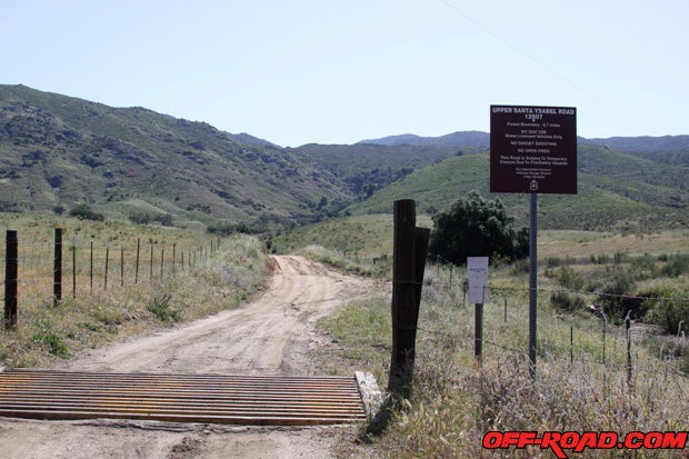
The gate to 12S07 – Santa Ysabel Creek Trail, with access to Black Mountain – is usually unlocked except for torrential rain or fires. |
There are a few access points that’ll get you headed out. If you turn north from downtown on Seventh Avenue, no more than four miles, one zig and a zag (get a map – know where you’re going) will drop you into Pamo Valley, which keys up Pamo Road all the way to the now-gated Lusardi Road (nicely ask the rangers – repeatedly – about when it’ll be open through to SR76). Along Pamo Road you’ll see the Black Mountain cutoff to the right (unimproved road 12S07), and that’s your turnoff for the five-mile run up Santa Ysabel Creek to Black Canyon, which is also accessible from just north of Ramona’s downtown via Black Canyon Road, a left off the 67.
You will recall unending mention of Ramona in league with every fire season to wallop San Diego. The wooded mountainsides (past tense, mostly) surrounding this hamlet tend to be more flammable than not, and the area’s reliable breezes don’t help. You can still find a few unmolested canyons, ones that preserve the aged charm of the area. Santa Ysabel Creek is among them.
PAGE 2
 |
|
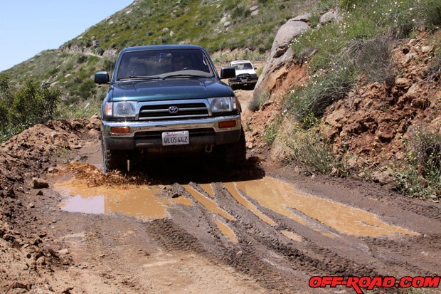
Mud is a definite maybe on the creek trail, another good reason to travel in packs with cool turbo’d gen-one 4Runners. |
About two miles up 12S07 out of the Pamo Valley is a Y-intersection with what looks like a 700R4 in the weeds to the left, on the embankment. The left spur at Transmission Junction leads uphill further, toward Black Mountain’s peak itself. Well, almost to the peak – it’s gated a few hundred yards from the top. The view from the peak of Black Mountain (4051 feet) does justice to the whole Ramona valley, though, and there’s a nice wide spot in the trail to break open the cooler. The rightward spur is the creek road, and the trail gets no more complicated from that intersection. Turn left, and you’ll also pass several of Ramona’s famous party points, which change season to season. One thing remains unchanged: the partiers take great care to clean up after themselves – folks in Ramona take pride in their backyard.
A roughly eastward route along Santa Ysabel Creek Trail (12S07) will bring you to Black Canyon Road itself (11S01). A right turn on 11S01 and a quick left (north) at the dueling bridges will bring you to Sutherland Lake and an adorable multiple-arch damn, but if you turn left at the eastern end of 12S07, you can follow Black Canyon north about five more miles, through very fine country to old Mesa Grande. A right at the pavement on 11S02 (Mesa Grande Road) will return you to SR79, and two rights (at the 79, and then the 78) will put you back in Ramona.
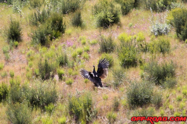 |
| Told you there were turkeys. No game driving; go on foot like a man. |
About Ramona? Most of this country is Cleveland National Forest, and camping is not really allowed. Some of these trails cross Indian land, so be polite. Ramona is open range, so don’t be surprised to see folks with a rifle or other trappings of gun sports. There are rumors of a sasquatch-type creature roaming the hills above Ramona, too, so if the big shaggy guy standing by the trail looks a little too big and a little too shaggy (and smells of carrion, so we’re told), don’t ask him for directions unless it’s with a .45.
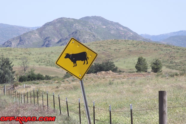
A portion of this terrain is also open range for grazing, so mind the cattle, because they won’t mind you. Ramona was also turkey country until a few years ago, when local animal-rights folks pushed a lot of ranchers out of state, so the area has seen a spike in wilderness-enhanced turkeys but fewer jobs. These weed peacocks have been loose long enough to be skittish, but they aren’t bright enough to mind being roadkill.
 |
|
Hmm, must be cow season. |
Surely, there’s other ways to get around on the trails above Ramona. Stories of locals getting in and out during the fires – on back roads, around police lines – were epic tales of adventure after the fires. Tell us where, tell us how, and help us find the next good spot to (legally) explore.
Small Ideas on Preparing for Trail AdventuresTruck and four-wheel drive guys, there’s no need for a long-ass commute to whereabouts unknown (though there certainly is a different adventure in that). Turn to your own backyard and local trails for a day in the dirt. Americans are seeking to shirk financial largess, and four-by adventurism has returned to the fore as an inexpensive way for the family to enjoy itself in vacation form. How excellent would it be to cap a two-hour trail run with a picnic? Consider it a bonding experience. Alternately, if you’re an Off-Road.com regular looking for a little adventure to cap your week, local access is a quick fix, and also a good way to trail-test new hardware.
PAGE 3
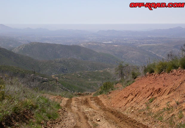 |
| Leaving Black Mountain, the trail drops off. In the distance, you can see the Pamo Valley grade and sections of 12S07. |
Basic off-roading skills are good to have – many of the bad habits folks get away with on-road are dangerous in the dirt. Take a course, or read a book or two, and go on an adventure with someone who’s done it before.
The preservation of access is an essential component to enjoying the backwoods of your own ‘burb, be it in North Carolina or Southern California. As soon as you leave it to folks not yourself to look after your right to drive on the dirt and two-tracks in the areas like Ramona, others have the opportunity to take them away. Be an advocate for your own interests. A core component to pushing into the wilderness in four-by style is to tread lightly, and that includes making an earnest attempt to be nice to Abominable Ramonaman before defending yourself. Trails like these take some care to keep, and part of the effort to preserve your access depends on you and yours being careful with the right-of-way. Ramona’s outback, in particular, has been resurrected after the nastiness of 2003, ’07 and smaller fires sprinkled between them, and your sensible use helps guarantee that those who’d close trails don’t have a chance to blame us.
Maps – buy one. GPS ain’t necessary, but it’s nice. Regional exploration requires regional knowledge, and joints like the local adventure shop or REI will have quality books. Benchmark Maps’ California Road & Recreation Atlas has proven useful, while DeLorme’s Colorado Atlas & Gazetteer is a necessity in the Silver State – more on that this summer. We’ve had luck with trail guides like those found at the Off-Road Expo in Pomona, such as the accurate localized trail books produced by the FunTreks guys, and Massey & Wilson’s generally comforting Backcountry Adventures: Southern California.
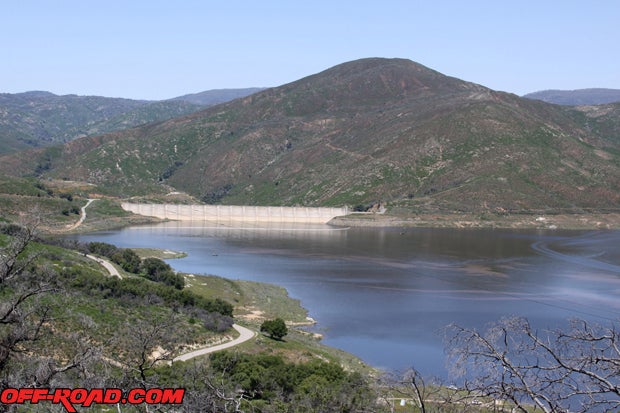 |
| Lake Sutherland sees a lot of local fishermen, but we’d like to see more of the obscure trails in the background. |
Knowledge is One Thing, Truck Is Another
Good tires are essential, and this means working tread depth, no leaks (or patched leaks that don’t), no abused sidewalls, and a tire that’s capable of a little gravel, rock and dirt use. If you don’t know what’s necessary, inquire at the local tire dealer and tell ‘em what you’re planning to do. Up-to-date maintenance is the second real necessity for your rig. It might get you to work, but will it idle for half an hour without overheating? Is it leaking something important that could drain on-trail and leave you dry (and leave poisonous puddles)? When was the last time you operated the four-wheel drive system? A visit to your mechanic with details of your plan is a good idea.
With a properly set vehicle (it doesn’t take much to get started) and a recovery doom-kit, which are available from outfits like Extreme Outback (extremeoutback.com) and Ultimate Trail Products (udshardware.com), the only further consideration would be that of the buddy system. It’s smart to take an outback adventure with a second vehicle, unless you like walking home with sasquatch, or you’re skilled at outback-style vehicle recovery. Maps are good, friends are better.
Is there a truck in your driveway? Find a trail for it.
 Your Privacy Choices