Backyard Off-Roading in San Diego: Otay Mountain Truck Trail
Look over the edge: exploring San Diegos border country from Otay Mountain Truck Trail via Minnewawa
Some backyard trails are excellent because theyre a quick run; others because they have sporty terrain thats close enough to home that you can head out, break things and still be back in time for waffles. There are also trails like Otay Mountain Truck Trail (and its feeder trails) that are excellent because of the access they offer to San Diego, access thats a little closer to the edge of the world than usual. That, and theres some fun terrain on the offshoots.
Otay Mountain Truck Trail: San Diego County
Pros:
- Good entry-level terrain with side action to entertain more serious knobby-tire fans.
- US-Mexico border views that you cant get anywhere else.
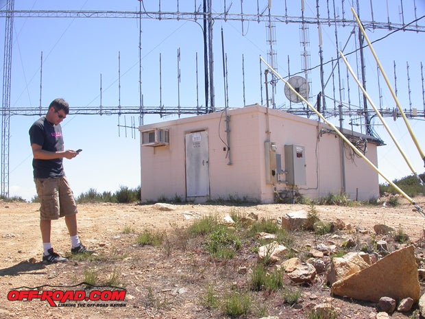
- Interesting interconnects that run up to Border Patrol lookouts and other odd spots.
- Most of the Border Patrol folks even agents who were clearly Border Patrolling are friendly and appreciate that you appreciate them.
- Long enough to make a day of it, short enough to make it home in time for the late Big 10 game.
- Multiple access points.
.")
Cons:
- The US-Mexico border is an ouchy neighborhood (not as much in San Diego as elsewhere, because weve got a decent wall, but its still the border), and the Border Patrol guys you run into are at the tip of the spear. Be nice, and stay out of their way.
- The trailhead is tricky to find from the traditional Otay Mesa point; the easy go-point is at the middle, from Minnewawa Truck Trail in Pio Pico.
- The trailhead on its eastern end at South Bay Rod & Gun Club puts you close to the US-Mexico border, and a wrong turn will make the Border Patrol edgy. Er.
- Even with the sportier spur trails, this is not a tough piece of road.
.")
Hard Points: What, Where and How
Route and Trailhead: We hit Otay Mountain Truck Trail (route #13502) by way of Minnewawa Truck Trail, which is accessible from Pio Pico on Otay Lakes Road, east of the Otay Lakes and Chula Vista. It ends in Engineer Springs at State Route 94, behind South Bay Rod & Gun Club via Marron Valley Road. From Pio Pico running south and east, its about 11 miles to Engineer Springs, or about 16 from Alta Road to Engineer Springs.
Terrain: main trial = graded dirt/rough dirt; spur trails = heavily rutted, silty dirt and loose rocky two-track. You wont spook yourself unless you want to. Longer trucks will be able to cope with most trail features, and the main Otay Mountain and Minnewawa routes can be traversed by two-wheel drive vehicles. Some spur trails are four-wheel drive-only.

Vehicle Requirements: main trail = two-wheel drive, good tires and a dash of ground clearance is enough; spur trails = four-wheel drive, tires that you trust.
Skill Requirements: main trail = novice; spur trails = better than amateur vehicle control, or novice with instructor/spotter and another truck.
Authors Equipment: third-gen 4Runner with more tics on the clock than Methuselahs Oyster Perpetual, four-wheel drive, rear locker, custom three-inch lift, worn Goodyear Wrangler Silent Armors @ 25psi, plus skills.
Pio Pico/Minnewawa Access to Otay Mountain Trail Complex
The friendliest access point to the Otay Mountain Truck Trail (OMTT) area is from the Minnewawa Truck Trail drop in (which we should call the drop up youll climb about 3000 ft. before coming back down). We used this entry point because there was a bit of Border Patrol... activity... near the western end of OMTT on Alta Road.

This trail begins in the hidden burg of Pio Pico. Take Telegraph Canyon east off the 805 freeway to Otay Lakes Road, past the Otay Lake lakes, and further east into old San Diego scrub country. Past the glider port, youll hit the little park-your-motorhome-in-these-enchanting-trees township of Pio Pico, where Minnewawa slopes uphill just west of the neighborhood store. Though Minnewawa is referred to as Otay Mountain Truck Trail by some, its not. It will take you south on an easy climb to Otay Mountain (3566ft), from which you can proceed east or west.
Minnewawa is paved for about 100 yards before turning into roughly graded dirt. This route (and several spur trails around the Otay Mountain area) are used by the Border Patrol, so the maintenance level is better than crummy. Youll quickly find of offshooty and spur trails, but because of the heightened national security activity near the border, several previously interconnecting trails that terminate in the lower valleys (escapey trails that made for entertaining side runs) are blocked. Fortunately, other subtrails that begin and end within the network are still open.

After about three miles on Minnewawa Truck Trail, it Ts into Otay Mountain Truck Trail (at a point called Doghouse Junction). Take a right, and youll loop back to the western end of the Otay Mountain trail at Alta Road on the original east-west stretch of OMTT. This route will afford you views of the coast and Tijuana, as well as the Border Patrol hard at work. Take a left at the T, and youre headed towards deep-country San Diego and Dulzura. While youre at the T, grab the turnoff to the antennas, and enjoy one or two sporty off-trail trails.
These trails are close by many southern San Diego communities (and San Diegans love their off-roading), so expect to encounter weekend riders and folks out for a play run on everything from motorcycles to trikes and quads and buggies, with a sprinkling of trucks and Jeepers (because license plates are cool too).

Finding and Using Otay Mountains Western Access
You dont need to go all the way to Chulajuana to get on the trail, but you can the original western entrance to Otay Mountain Truck Trail is across from the Donovan State Prison. It is now partially obstructed by businesses that, for some reason (cheap real estate? plentiful labor?) wanted to be located directly across from a prison.
With the trail somewhat hidden on this end, youll need to use one of the businesses dirt driveways to angle your way onto a dirt frontage road on the east edge of Alta Road. Friends of the author have had better luck deciphering the western access by approaching from the east. A good description of the western access point is posted at Dirtopia.

There are plentiful good looks at the network of almost-roads that connect Alta Road the Otay Mountain Truck Trail trailhead online.
If you plan to use the western access point to Otay Mountain Truck Trail, take the 805 to the 905 east from most of San Diego, using La Media to link north to old Otay Mesa Road, which heads further east to a left turn on Alta Road. Do yourself a favor and mind the freeway signs this area is hard against Americas border with Mexico, and it comes up quickly. Signs about Last U.S. Exit and Firearms are Illegal in Mexico are not there for fun.
. If you dont have a kit (straps, jacketed frame loop, gloves and a D-ring block for the hitch), just stuff the same bits in an old backpack.")
While passing through this area, youll also get to see the 125 toll-road. Currently dubbed the South Bay Expressway, it will soon be renamed Government Sedan and Expense Account Expressway. Seriously, no one else uses the thing worst highway ever.
East from Doghouse Junction to Engineer Springs and South Bay Rod & Gun Club
Dont confuse the Otay Mountain Truck Trail complex with a tough road its not. There are fun byways and offshoots with enough mustard on em to make this hot dog worth eating, but the main road is going to be used and used again by Border Patrol agents hard at work. Remember, youre close to Mexico, and some of these side trails take you very close to the border. Theres that warning about situational awareness again dont be a dummy, be aware of where you are, and know which wheres what.
.")
Speaking of sporty spurs, however, they ARE to be had. A little less than six miles in from Pio Pico, heading east past the left turn at Albuquerque, theres an off-trail ridge route that peels from the main trail to the right, and probably hits a 2.5 on the five-scale for terrain challenge. You will need four-wheel drive, and airing down wouldnt hurt. This trail spur is used by Border patrol agents to get their Tahoe-based sentry rigs to the best vantage points possible, so the trail sticks pretty close to the ridgeline itself.
, everyone we met in the Otay Mountain trail complex was supercool. After this crew stopped to see if we were stuck (articulation pics we were playing), we followed them down the sporty spur pictured next.")
From Otay Mountain onward, youll begin a consistent loss of elevation that extracts you from the highest points of the trail, eventually passing Donohue Mountain on the left. Several more trails spur off during your descent into the lower reaches of OMTT, including a lengthy one to the right just past the high-tension power towers carrying cheap, dirty coal-powered electricity from Mexico to San Diego. These offs and off-offs can very quickly put you at the Mexican border again. There are also several nice pads beneath the power towers that make for a great place to picnic, if you like EMF radiation with your peanut-butter & jelly.

Respect the Badge Your U.S. Border Patrol is on the Job
At approximately ten miles along (having taken Minnewawa to Otay Mountain Truck Trail east), youll reach an almost-done point that has harried many otherwise attentive drivers. When you find a wooded intersection with a sharp left and a soft right, go left thats north. A short stint on this northbound trail rolls you right into the backyard of San Diegos very own South Bay Rod & Gun Club, which is a big shooting facility built in the 50s (sbrgc.org). From there, you continue on towards Highway 94 via Marron Valley Road.

If you turn right, prepare for some surreal San Diego. Youll find a two-level road that roughly forms southbound Marron Valley Road, and which is one-half rough macadam and the other dirt. The trail leads through some very old nooks of backcountry San Diego to the border and, you guessed it, a rather tense Border Patrol agent. Be polite, wish them an uneventful day, and turn around. This area of San Diego, like it or not, is an American demilitarized zone (DMZ), which, as you should know, is anything but. Considering the 30-mile penetration of the American border in Arizona by the narco-cartels, traffickers and smugglers, the serious enforcement efforts by the Border Patrol in Southern California are understandable and appreciated.
 but didnt want to push our luck we were close enough to Mexico to use our international calling plan.")
|
Off-Road.com Newsletter Join our Weekly Newsletter to get the latest off-road news, reviews, events, and alerts! |
Follow @Off-Road
 Your Privacy Choices