|
There are some
off-road passages in Colorado that are notorious. Whether due to their
altitude, their rocky surfaces, their deep river crossings or the number
of lives they've claimed, these routes have bad reputations. Almost all
were built by 19th Century gold crazed fortune hunters who would stop at
nothing.
Originally they were
foot paths, later becoming mule train routes and then wagon roads. They
connect low valley towns to the gold bearing ores of the high Colorado
peaks. Carved into the precipitous heights, these routes came to be years
before the "Iron Horse" facilitated travel between once remote
mining towns. They are impassably snowed-in for over 9 months of the year.
Normally they open in early July only to be snowed-in again by the end of
September. Remote, arduous, and inconvenient for most, they no longer fill
a "useful" purpose in our modern age of fast highway travel.
They have since become the realm of off-road adventurers.
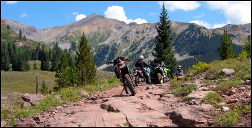
Of all the high 4wd
passes in Colorado only 4 or 5 achieve the status that make dualsport
riders pucker with excuses of why they can't go. Two of these
"pucker" passes are Schofield and Pearl. Both cross the
14,000-foot Elk Mountains, which lie between Crested Butte and Aspen. We
were determined to test ourselves in a long dual sport day over these
passes and more. The following is the account of those events.
Ever since I learned
of Pearl Pass it has been on my hit list. Located far from Denver with a
very short weather window, Pearl had remained elusive until now. Being
well into summer season, I was reasonably confident that Pearl would be
clear of snow. Schofield, however, remained somewhat dubious. Rumors told
of a "snow-plug" blocking Schofield. Comprised of twisted trees,
rocks and compacted snow, it is the result of avalanches that fill a
narrow valley up to hundreds of feet above the valley floor. Never having
seen a snow-plug before I was not sure what to expect. The many rumors
regarding these two passes did not help.
Finally, in mid
August friends in Crested Butte informed me that dirt bikers had breached
Schofield Pass. I put the seed out and recruited 3 other intrepid DS
adventurers. If we were truly going, the time was now for soon the Fall
snows would be upon us. We made a sunrise departure out of Denver on
August 28th. Our ambitious one-day plan was to ride a combination of
twisty two lane black top, dirt roads and 4wd passes for a speedy arrival
to the Crested Butte valley 200 miles away. From there our goals of Pearl
and Schofield Passes would hopefully be achieved.
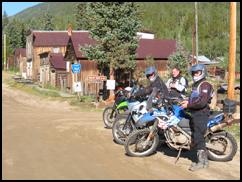
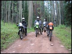
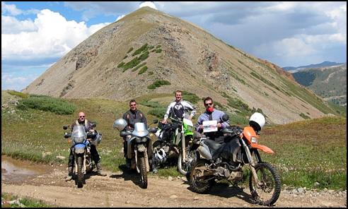
Saint Elmo where Tincup Pass begins. Dana,
Dan & Scott |
Tincup pass between St. Elmo and Taylor Park
- Scott on the LC4 |
Tincup pass between St. Elmo and Taylor Park
- Dan on the KLX 400 |
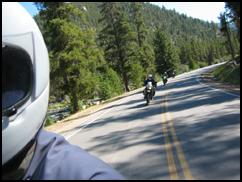
Sportbiking the paved portions in Taylor
River canyon |
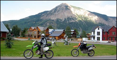
The group consisted
of Dana on his BMW 650 GS Dakar, Scott on his KTM 640 Adventure, and me on
my KTM 640 LC4e. We would meet Dan on his KLX 400 in Fairplay. The group
of us were all well seasoned off road motorcycle riders with a desire to
ride long and hard. Our thumpers streaked across paved, high altitude
Southpark with ease. Passing the ghost town of St. Elmo we crossed 4wd
Tincup Pass, dropped into Taylor Park, and then headed down the twisted
pavement of the Taylor River canyon. Crested Butte grew closer as we
leaned our dual sportbikes into corner after corner. We arrived at the
Pearl Pass turn-off at 11 AM after a brisk 200-mile warm up ride. Ahead
lay some of the most spectacular and precipitous mountains on the planet
and a pass with a baaad reputation!
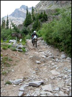
The Pearl Pass
Crossing:
Smooth county dirt road gave way to 4wd as our path led up Brush Creek. A
rocky water crossing woke us up with a jolt. Climbing out of the
sage-filled valley into shimmering aspen forests we made our way through
mud bogs. Soft ground gave way to rocky roads and dark pine forests as we
climbed ever higher into the glaciated valleys surrounded by volcanic
spires.
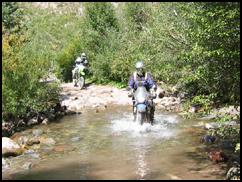
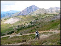
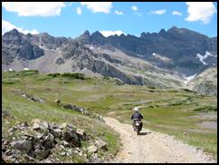
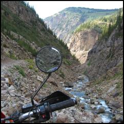
The first river crossing going up the
Crested Butte side of Pearl Pass woke us up after the long ride
getting there |
Climbing through the aspen forests on the
lower portion of Pearl |
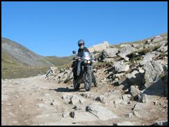
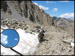
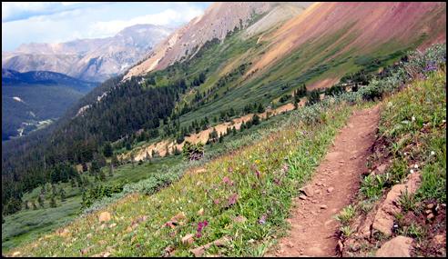
At 11,000 feet on the South side of Pearl,
the pine forests gave way to high alpine valleys and solid rock
roads |
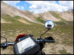
The views looking into the Elk Mountains
from Pearl Pass Crested Butte side |
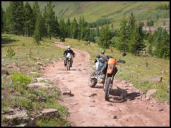
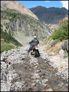
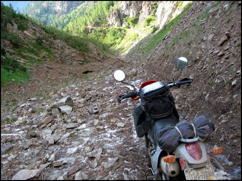
The road became
increasingly difficult. Dana's more street-oriented BMW 650 was reaching
its limits. The incessant bumps caused the Dakar's fairing to lose the
mounting bolts in protest.
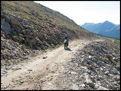
Somewhere up there is the summit of Pearl
Pass |
The "road" up Pearl's south side |
Dana and his Dakar ascending the rocky south
side of Pearl Pass |
As we pressed on
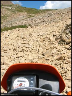
towards the 12,705-foot summit, Pearl's infamous rocky roads and scree
field traverses dwarfed our bikes and efforts. From grape fruits, to baby
heads, and then to watermelons the rocks were everywhere. Luckily, there
were no deep snowdrifts to contend with. On these rough roads and at these
altitudes jetting is critical. If your bike won't carburate cleanly down
low it will be near impossible to ride in the high elevation rough stuff.
Thankfully big four strokes with their high torque output are less finicky
in this department.
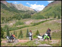
The summit of Pearl Pass crossing the Elk
Mountains visible in the background |
Dan on his KLX 400 nearing the summit of
Pearl Pass with views towards Crested Butte in the background |
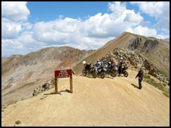
Parked on the dizzying heights of Pearl's
12,700 foot summit |
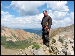
Scott on Pearly crags. One can almost see
the curvature of the earth from here |
Dana descending the north side of Pearl Pass
on his 650 Dakar |
The north side of Pearl Pass is simply
majestic |
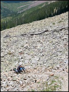
Colorado 4wd roads
demand proficiency when it comes to rock riding. Pearl was on the extreme
side of this demand. Clawing our way up the loose scree field of a road
the summit came into view. The off-road capable LC4s were just the ticket
for this hardcore terrain. Once on the summit, Pearl Pass offers
magnificent views of Colorado's most spectacular peaks. The volcanic rock
of the surrounding 14,000 foot mountains has weathered into awesome
formations. The lower portions of these mountains are layered with
horizontal bands of sedimentary rock. The overall effect is awesomely
beautiful and geologically fascinating. The water flowing down the road on
the north side conspired with gravity and erosion to reclaim their domain.
The rock fields rewarded some riders and punished others as we picked our
jarring line downhill towards the ghost town of Ashcroft.
| As
we descended Pearl we searched for the spot this 1910 photo of the
old time adventure riders was taken. We found the spot and did a
photo of 2005 adventure riders for a comparison |
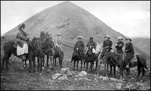
1910 photo from Denver Public Library
archives
|
2005 photo © Steve Green aka Esteban
|
Scott on his KTM 640 LC4 Adventurer
descending the north side of Pearl |
The bottom of Pearl Pass "road"
near Ashcroft |
After a challenging
descent we found ourselves 4000 feet below on the valley floor in Ashcroft
. It was 4 PM when Dana and Scott informed Dan and I that they had decided
to head back to Denver on the paved route via Independence Pass. Rides
like this can change hearts, minds, and bodies sending fellow riders home
in retreat. Dan and I kept true to the original plan and headed towards
Schofield, taking advantage of the long Summer day.
The single track back to Crested Butte |
Dan riding the steep and narrow |
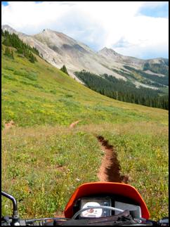
True unadulterated motorcycle single track |
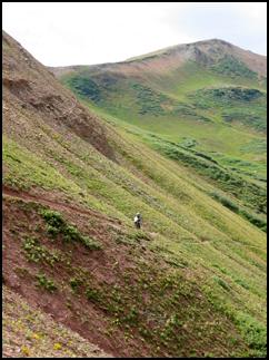
With limited
daylight we high-tailed it up 4wd Taylor Pass road to ride 15 miles of
12,000 foot single track clinging to the flanks of the Elk Mountains. This
area has some of the finest trail in all Colorado. The sinuous 12"
wide path led us down into Crested Butte from where we began our next
climb over Schofield Pass.
A visit to the town of Crested Butte before
making our way towards Schofield Pass. It was just Dan and I now |
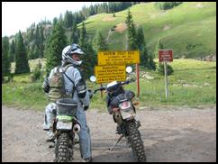
The Schofield
Pass Crossing:
Although not particularly high at 10,707 feet, Schofield Pass is one of
Colorado's most infamous 4wd roads. It has claimed its share of four
wheelers' lives. Back in 1970 it was the site of Colorado's worst ever 4wd
accident when a carload of people plunged into the river at the bottom of
Devil's Punch Bowl. A faulty parking brake during a photo op was said to
have been the cause. As Crested Butte faded behind us we climbed the old
miners' trail past the town of Gothic. The road thus far was fairly easy.
Above us, the steep bare mountain slopes showed recent evidence of
powerful winter avalanches. The ledge road took us above the narrow valley
below which was filled with a thick accumulation of ice, snow and rock
that had cascaded down the mountainside during the last winter season.
Wide swathes on the mountain slopes were stripped bare and trees lay below
in jumbled piles. In the Winter this valley is lethal.
Warnings on the way to Schofield |
More warning signs taken out by avalanches
on Schofield Pass |
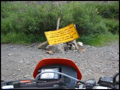
Further up the road,
yellow travel advisory signs warning the unwary to turn back were ripped
from the ground and broken into pieces by avalanches. The road became
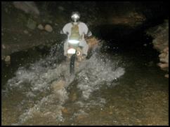
rockier as we approached the notorious Schofield Pass river crossing. At
earlier times in the year, this river poses a formidable obstacle due to
the swift current and deep water. Vehicles attempting to cross early in
the season can easily be swept into the steep ravine and jammed into the
rocks below. The last time I was here I had to throw a line to an ATVer
whose vehicle was off course and being swept downstream. Crossing this
late in the summer assured us of calmer waters.
Crossing the river just above Devil's Punch
Bowl on Schofield Pass |
The Devil's Punch Bowl on Schofield Pass |
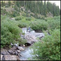
Once past the river,
the more difficult 4wd section begins. Descending along the edge of the
Devil's Punch Bowl we passed the site of past 4wd fatalities. Up to now we
had seen no other vehicles. After passing what is normally the toughest
part of Schofield we thought we were home free. A half mile further and we
saw the reason no other vehicles were around. Ahead the road disappeared
under a 60-foot pile of twisted branches and rocks all cemented together
with ice and packed snow. It was the dreaded "snow-plug" The
first we had ever seen, it was like a glacier filled the valley. Below,
the river had carved a tunnel through the mass of ice, while above a
skinny single track trail showed where bikes and foot traffic had gotten
over. After riding to the top of the snow-plug we began our slippery
descent in first gear, engines off, feet down. We met a solitary dirt
biker going the opposite direction. He was struggling to get traction
uphill and return to Crested Butte. Bikes and maybe ATVs could get
through, but jeeps - no way! The ice age had returned to Schofield Pass.
Riding over the debris covered snow-plug on
Schofield. The road is about 50 feet under us |
Underneath the
trail, the snow-plug was hollow. Crevasses had formed where sun and water
had eaten into the frozen mass. It would not support much weight. I found
this out the hard way near the bottom when the ice gave way under the
bike, and my LC4 and I tumbled into a crevasse! Luckily it was not too
deep and Dan helped get us out after snapping a few pics.
|
Oooops,
gotta watch out for those snow plug crevasses
|
|
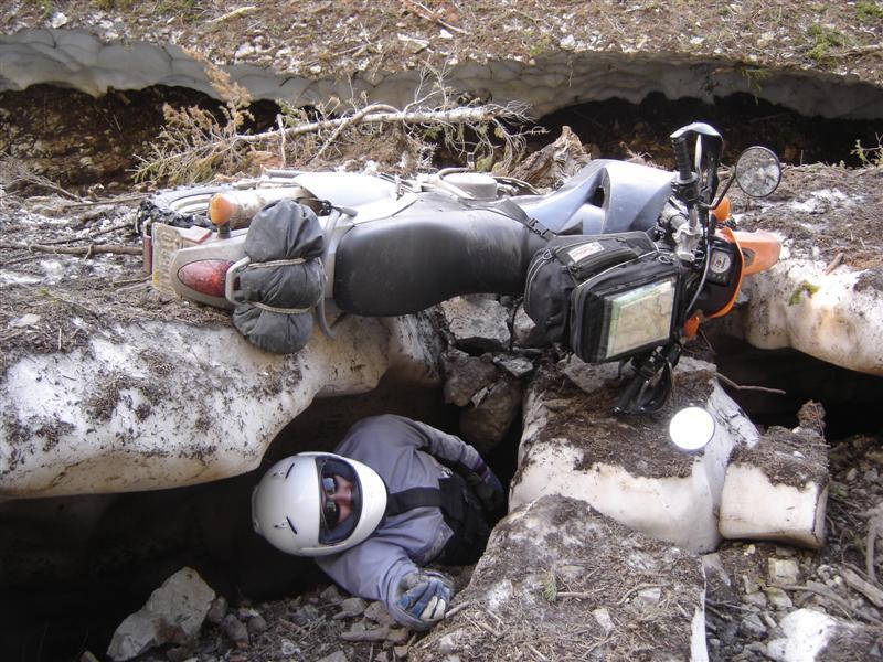
Photo: Dan Bartolo
|
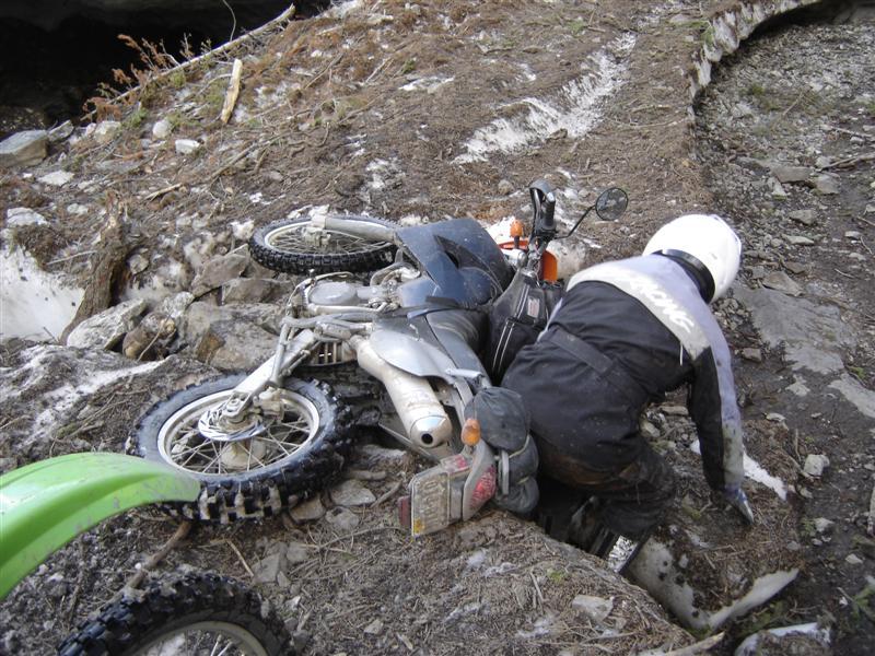
Photo: Dan Bartolo
|
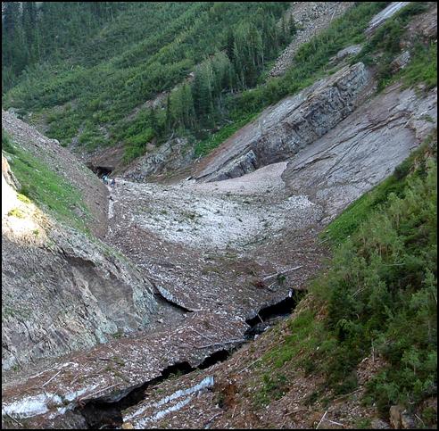
The snow-plug covering the road viewed from
a distance. Note the bike on the top of the snow-plug for judging
size. The Schofield Pass road is visible on lower left blocked by
the plug |
Schofield Pass road
eventually leads to Marble, Colorado - a sleepy little town that is home
to some of the purest white marble in the world. The marble in the
Jefferson Memorial [in Washington, D.C.] came from here.
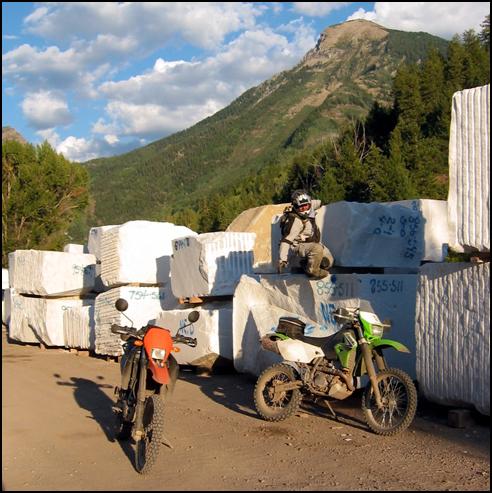
We finally arrive in Marble after Schofield
Pass |
The time was nearing
8 PM as we began our ride home. Taking pavement to Carbondale and Basalt
we headed over Hagerman Pass to get a late Sunday night dinner in 10,000
foot Leadville. Dan and I were both pretty tired, but the allure of doing
13,000 + foot 4wd Mosquito Pass at midnight proved irresistible. Our
headlights were the only two light sources on the pitch-black Mosquito
Range. Twenty minutes and 3000 feet later we were toasting at the summit
with a billion stars above.
|
Water
crossing in the dark on 4wd Hagerman Pass nearing Leadville
|
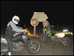
Photo: Dan Bartolo
Esteban
on 13,185 foot Mosquito Pass at midnight
|
From here it was
down to Fairplay and Southpark for the paved ride home. Once again our
modern thumpers were impressive in their ability to cover distance and all
types of terrain at speed. From single track to black top the 440 miles
and 20 hours in the saddle added up to another phenomenal Colorado dual
sportbike ride.
|
 Your Privacy Choices